Cite
MLA
“How was Ram Setu formed?.” Hindu History, 2026, https://www.hinduhistory.in/vimarsha/ram-setu-formation/. Accessed .
APA
Hindu History. (2026). How was Ram Setu formed?. Retrieved , from https://www.hinduhistory.in/vimarsha/ram-setu-formation/
What defines it
- 01
Nala, son of Vishwakarma, builds the Setu in five days
- 02
About 29 km of shoals, Dhanushkodi to Mannar
- 03
99.98% submerged (NRSC, 2024)
- 04
Rajya Sabha statement, December 2022
- 05
Sethusamudram channel dispute, 2007
01The Setu in the Ramayana
In the Yuddha Kanda Shri Rama stands on the shore with the Vanara army, and the ocean will not give way. Samudra himself rises from the waters and tells him that Nala, son of Vishwakarma, can build a bridge that the ocean will bear. The Vanaras haul trees and rocks, and in five days Nala’s Setu is complete; Valmiki gives its size as a hundred yojanas long and ten wide. At Rameswaram the Ramanathaswamy temple keeps the memory of Shri Rama’s worship of Mahadev before the crossing, and at Dhanushkodi pilgrims bathe where the Setu begins. The name Adam’s Bridge on colonial charts comes from a different, later tradition.
02What the satellites see
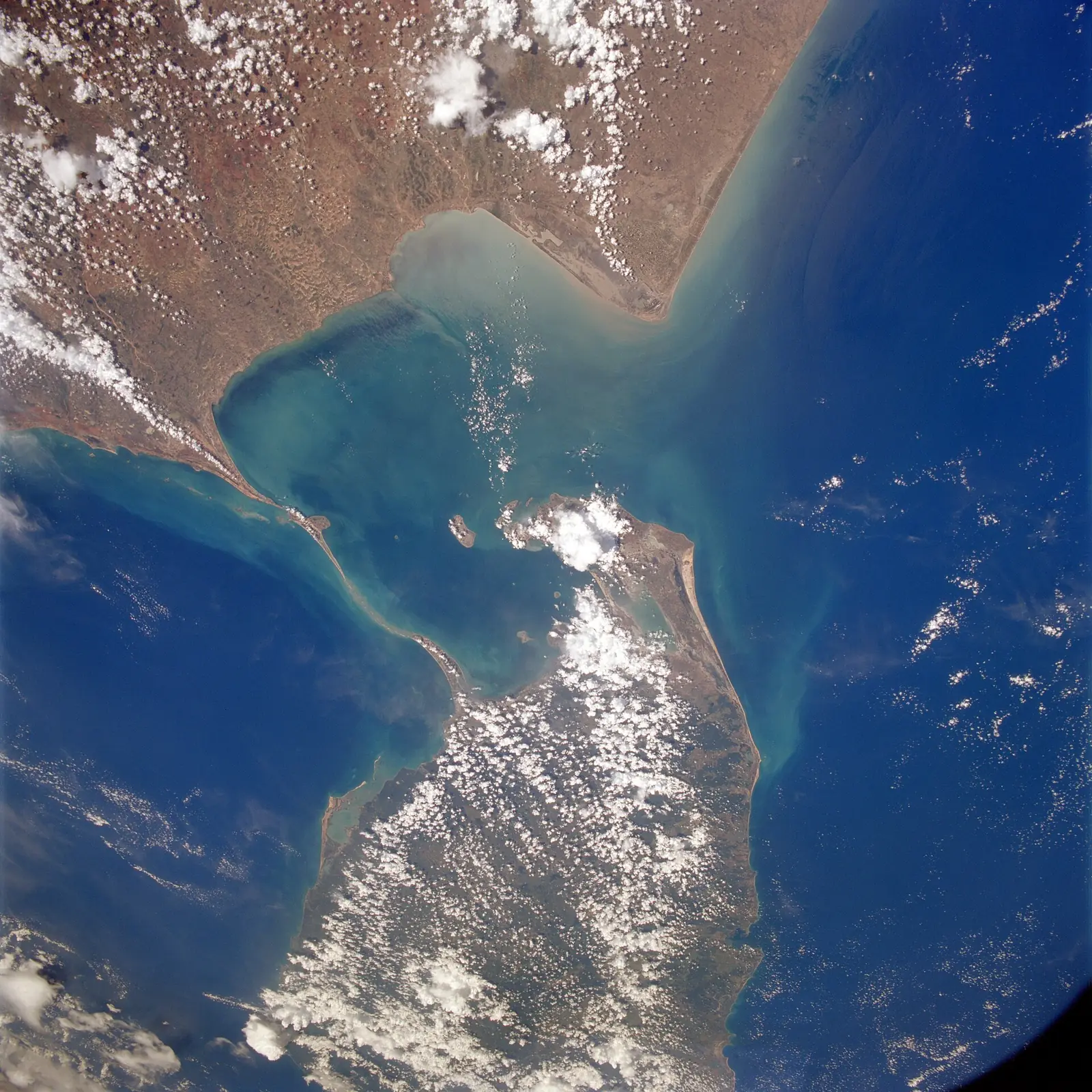
In 2024 scientists of ISRO’s National Remote Sensing Centre at its Jodhpur regional centre, led by Giribabu Dandabathula, published in Scientific Reports the first detailed undersea map of the whole ridge, from laser data gathered by NASA’s ICESat-2 satellite between 2018 and 2023. They found 99.98 per cent of it submerged, rising on average about 8 metres above the seabed, and cut by eleven narrow channels 2–3 metres deep. In December 2022 Union minister Jitendra Singh told the Rajya Sabha that satellite images show islands and limestone shoals which cannot be accurately said to be the remains of a bridge, and that such images cannot directly give its origin and age. The ridge had already become a legal question in 2007, when the Sethusamudram shipping channel threatened to cut through it.
The positions
Built by the Vanara sena for Shri Rama
Valmiki Ramayana (Yuddha Kanda); the tradition of Rameswaram and Dhanushkodi; petitioners such as Subramanian Swamy before the Supreme Court
The Ramayana describes the bridge in detail, names its builder, the days it took and its size, and puts it exactly where the ridge lies, between the coast of Rameswaram and Lanka. The region has worshipped it as the Setu without a break, and its place names, Dhanushkodi, Setu, Rameswaram, carry the memory. Supporters point out that the satellite studies describe the present shape of the ridge and say nothing about how it came to be, a question the NRSC paper itself does not address.
No geological or archaeological study has yet reported worked stone, mortar or tool marks in the ridge, and the material described so far is limestone and sand of the kind such shoals form. A sacred identification does not by itself tell us what lies inside the shoals.
A natural ridge of shoals
ISRO’s National Remote Sensing Centre (Scientific Reports, 2024); the government’s statement in the Rajya Sabha (2022); geologists of the Gulf of Mannar
The ridge is a line of sand cays and limestone shoals on a submerged sill between two seas, the Gulf of Mannar and the Palk Strait. Such features build up where currents meet and carry sediment, and when sea levels were lower the strait was dry land joining Bharat and Lanka. ISRO scientists, presenting their 2024 map, said the data corroborate a natural, geological origin for the limestone structure. The government’s own statement in 2022 spoke of islands and limestone shoals, not a structure that could be called a bridge.
Remote sensing measures shape and depth, not origin, as the minister himself told Parliament. A natural ridge and a causeway built along it are not exclusive: a bridge laid on a natural shoal would leave a natural ridge behind. The questions of what lies inside the ridge, and of its age, need coring and dating, not images.
Cores drilled through the ridge at several points, with each layer dated, would show whether any part was laid rather than grown, and when. An underwater survey of the shallow sections looking for worked stone would help. And whatever is done should be published in full, so that devotees and scientists can read the same evidence.
Great masters
In the texts
- Valmiki Ramayana, Yuddha Kanda, sarga 22